Navigating the small streams of Christian County, KY
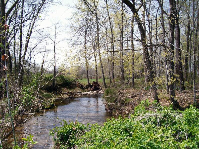
South Fork of the Little River
Little River, a tributary of the Cumberland River, originates in Christian County, KY. Its floods are a recurring theme in the history of Christian County and Hopkinsville.
As I was reading old Kentucky New Era articles about Pilot Rock recently, I came across some interesting information about Little River. In the Dec. 9, 1959, issue, a columnist reprinted an old clipping that a reader had sent to him. The author and original date of publication were unknown but it was believed to be from the New Era. The topic was the navigation of Little River in pioneer days. Part of the clipping quotes a law that was passed:
An act for keeping open the navigation of Little River in Christian County, KY., approved Jan. 4, 1811.
"Whereas it is represented to the present general assembly (probably of Kentucky) that great advantage would result to the inhabitants of Christian County (organized in 1792), by prohibiting all obstructions in the navigation of Little River.
"Therefore, that from and after the passage of this act, Little River shall, as a navigable stream, remain open and unobstructed for the purpose of navigation and any person erecting or causing to be erected any fish dams, bridges or any other obstructions to passage of boats up or down said stream, shall for every offense forfeit and pay the sum of three dollars to the person aggrieved, to be recovered before a justice of the peace for every 24 hours such obstruction shall remain therein."
Source: Kentucky New Era, Dec. 9, 1959
This little item sheds some light on a question that Dennis and I had discussed a while back -- whether Little River had ever been used for shipping and transportation. We were quite sure that it had been, but it's fun to find some documentation.
 The various headwaters of Little River are not very deep, but flatboats didn't need deep water. They were built at the place where the freight originated, and they were one-way vehicles. They were floated downstream, but they weren't brought back upstream.
Their [the flatboats'] cheapness and shallow draft enabled them to carry freight on most creeks worthy of the name. The produce was loaded while the creeks were more or less dry; then when a freshet occurred they were floated to the nearest river.
Source The Encyclopedia of Louisville (p. 849) by John Kleber.
After a flatboat was unloaded at the end of its trip, it was torn apart to salvage the lumber. The sale of the lumber was one more bit of income from the trip.
Dennis and I speculate that in early 19th-century Christian County, bridges across streams would have been primitive. They were probably just a tree trunk, laid across a narrow place. A fancy bridge might have been two trees, laid across the water side by side, with planks nailed across them. No wonder they were prohibited on Little River. Besides obstructing traffic, they would have snagged flood debris.
But who needed a bridge? If the river couldn't be forded, it was an opportunity for someone to make some money operating a ferry.
3 comments:
Interesting article on the use of flatboats for moving freight. The whole of the river systems in Kentucky is one that I would like to explore. Thanks -- barbara
With the amount of water in the river normally, i find it hard to believe that it was used to move freight. Maybe closer to cadiz, but if you went by the water level at the park downtown, there would be a lot of getting out and pushing!!!
John
We often say that Little River runs through Hopkinsville, but that's only partly true. The North Fork of Little River goes through downtown Hopkinsville and Millbrooke. The South Fork of Little River runs through Trail of Tears Park and along Woodmill Road. (Greatly simplifying their routes, here.)
When the North Fork and South Fork converge, they become Little River. That doesn't happen until the forks are a few miles southwest of Hopkinsville, near the intersection of Lafayette Road and Gary Lane.
I think that during periods of high water, there would have been plenty of water to float a flatboat from the point where the two forks join -- and probably even from some points above. The flood levels in the North and South Forks weren't moderated by watershed lakes (as they are now.) A flatboat only needed a few feet of water anyway, even when loaded. River bends, low branches, and blockages were probably the greatest dangers, not running aground.
I found quite a number of books with info about flatbook shipping. This book mentions waiting for a flood -- first full paragraph, right column. Here are more examples of flatboats on small tributaries and waiting for high water. I also read (didn't keep the URL, sorry) that it was common to have community work days for clearing the rivers.
Post a Comment