Saturday, February 27, 2010

Scanning Family Pictures

My concerns about scrapbooks


In 1995, as my parents' golden wedding anniversary approached, they decided that they should organize their photos. So Mama and Daddy spent many hours, looking through their photos and newspaper clippings and arranging many of them in chronological order. They taped (yes, taped!) them into scrapbooks, and for a few of the photos, they wrote captions. They enjoyed making the scrapbooks, and they enjoyed showing them to the friends and family who gathered to celebrate their 50th anniversary.

My parents have both been gone for over a dozen years, but my brother, my sister, and I haven't divided the family pictures yet. I hope that day will come eventually, but for now, I'm scanning photos from a couple of scrapbooks that I brought home from my brother's house last fall.

The scrapbooks and the taped-down photos are a bit of a problem. I can't remove the photos from the pages for scanning, so I opened the hinges of one of the scrapbooks and took out the pages. I have to make two scans for each side of each page. Then it takes a fair amount of time with image processing software to crop the individual photos, straighten them, and save them. I have an older Canon scanner. It works well, but it doesn't do many things automatically.

The worst problem is that we can't divide the photos in the scrapbooks without destroying the scrapbooks. For example, it would be nice if I could have some of the photos in which I appear -- the original photos, not just scans of them. Pictures of me as a child won't mean much to my five nephews and their descendants, whereas my own children and grandchildren might value them. Is that more important than keeping the photos in the scrapbooks that my mother and father created?

The photographs probably should be cut loose from the pages, whether or not we ever get them divided among the three of us. I am very sure the scrapbook pages are not made of acid-free paper.

Scanning these photos has made me wonder about the scrapbooks that many hobbyists enjoy creating today. How will their children share the family photos and memorabilia that are embedded in fancy scrapbook pages? No one will want to ruin the pages, so one person will inherit each book and its contents. I hope that the scrapbook crafters are saving duplicates of the photos or creating similar scrapbooks for each child.

People like to decorate their scrapbook pages with embellishments that they purchase at scrapbooking shops. Little doodads of any thickness would be a problem on my scanner. If a page doesn't lie flat, I don't get a well-focused scan. I'm glad my parents' scrapbook pages are not lumpy!

I think I'll try to write some information on the backs of my own photographs, instead of putting them in scrapbooks. If the kids want them organized chronologically, they can do it themselves.

Wednesday, February 24, 2010

Buggy

Mennonite neighbors, headed home


Life slows down on our country lane -- sometimes, anyhow.

Monday, February 22, 2010

WPA and PWA projects in Hopkinsville, KY

How some Depression-era projects were funded


Recently, I read some grumbling on the Hoptown Hall about a couple of grants that supposedly are approved for Hopkinsville. Some citizens are unhappy about the amount of local matching money that will be required to construct a foot bridge over Little River and a public restroom along our future rails-to-trails project.

These are Federal "stimulus" grants (I think, could be wrong), so I wondered how the 50/50 ratio of Federal to local funding compared to the Depression-era projects of the W.P.A., P.W.A., etc. that were completed around Hopkinsville.

In the Google News Archives, I found a Kentucky New Era article from January 1, 1937. It lists many public projects underway and in planning. The article states that the mayor intended the improvement of Seventh Street "from city limit to city limit" (U.S. Route 68) to be financed entirely with federal funds.  Other projects mentioned in the article include:

→ Sewer system and disposal plant improvements
Total cost: $405,000 / Federal funding: $182,454

→ High school auditorium with seating capacity of 900; Virginia Street School auditorium and four classrooms
Total cost: $55,000 / Federal funding: 45%

→ New bridge on North Main; street improvements on North Main; street improvements on South Main from 1st to 9th Street (downtown area)
Total cost: $79,000 / Federal and state funding: $70,900

→ War Memorial Drive built in Riverside Cemetery
Total cost: $2000 / Federal funding: $1800

→ Ninth Street Bridge
Total cost: $26,000 / Federal funding: $22,000

The article also listed some WPA projects that were approved, though not yet begun. No breakdown is given of the origin of the funds, but it's interesting (as a resident of the area) to see what the projects were.

Completion of Walnut Street from the bridge to the Twenty-first Street intersection; and Tenth Street from Walnut to Campbell; Virginia Street from Sixth Street to Twenty-fourth Street; Main Street from Ninth to Alumni Avenue; Canton Street from Fifteenth Street to city Limits; Jessup Avenue from Seventh Street to city limits; Fourteenth Street from Main to Walnut; construction of a stone building at Ninth and Belmont Streets as a permanent home for the Red Cross with the total cost $3450; painting, roofing and general repair work on the Public Library, total cost of $2886; on Fire Station, total cost $1809; on jail-workhouse, total cost $921. (Source: "Many Have Work on City Projects", Kentucky New Era, January 1, 1937)

Some of Hopkinsville's residents contributed directly to street work as well as contributing through taxes. In March 1938, the Kentucky New Era reported that residents of Virginia Street would pay 87¢ per foot for the curbing and guttering along their property fronts, as part of the street improvement project. The total cost to the city for the paving was expected to be $12,000-$15,000.

In April 1938, local officials announced that the Virginia Street project had exhausted current city funds for street-building. Main Street residents would pay considerably more for their curbing and guttering than the Virginia Street residents had paid -- if the project ever came to be.

The citizens of Hopkinsville in 1937 couldn't rant on an internet forum, but I'll bet the street-building projects were discussed thoroughly in every public forum of their day.

__________

At right: South Main Street in Hopkinsville, today. Looking north toward the intersection of 9th and Main.

Monday, February 15, 2010

A Thin Icy Crust

Slick, but not thick


The students of Christian County, KY, were supposed to attend school today -- President's Day -- to make up one of the many "snow days" they've enjoyed recently.

Old Man Winter intervened. Sunday evening, a thin glaze of ice formed on the roads, and half an inch of snow fell on top of it. The new surface was very slick, so school was canceled today. The holiday, which had been declared a make-up day, became a holiday again.

This morning, Dennis decided he would push our wheeled trash-bin down our hill (pictured below) as he  usually does. (He always thinks it's easier to push the trash down than to load the trash-bin into the truck and haul it down.) When he got back to the house, he admitted that he had fallen. The new glaze over the old snow-pack on the hill was slicker than he had expected. Fortunately, he didn't break any bones.

I felt a little shaken by Dennis's fall as I left for work. The small rural blacktops had a white icy crust. I was determined to avoid the vehicular equivalent of falling on the ice, so I drove with an excess of caution. Finally, I reached larger highways that had been salted. I was a little late for work, but I arrived in one piece. About half of the staff stayed home, so it was an interesting day.

Isaac was home from college this past weekend. He went back yesterday before the precipitation began freezing on the roads. When I talked to him on the phone this evening, he told me that the sidewalks on the Murray State campus were treacherous this morning. He nearly fell several times on his way to his first class.

If Keely had any mishaps due to the ice, she didn't tell me. She's careful because she doesn't want to re-injure a previously sprained ankle.

I hope we -- and you, gentle reader -- can all get through this season without accident or injury. Be careful!

Wednesday, February 10, 2010

More About Boats on Little River


After doing some intensive research both on the internet and in my own collection of books, I have some things to add to what I wrote earlier this week about boats on Little River in Christian County, Kentucky.

First of all, I found out that the Little River clipping I quoted in my previous post had a few words left out of it. The 1811 act that declared Little River a navigable stream of Christian County, KY, actually said that it could not be obstructed from its mouth to "the mouth of sinking fork of said river." The Sinking Fork comes into Little River a few miles southeast of Cadiz (about 15 miles west of Hopkinsville).

Also, I came to realize that in 1811, Trigg County had not yet been created. It was still part of Christian County. So, what the legislature was calling Christian County in 1811 is not the same as what we call Christian County, today.

An 1815 act of the Kentucky legislature established Steel's Mill as the terminus of the portion of Little River that was reserved for navigation. I haven't been able to learn the location of Steel's Mill, but I think it might have been somewhere near the confluence of the Sinking Fork and Little River. Smaller boats could still have been used above that point; however, the river could be obstructed by foot bridges, mill dams, and the like. (I read about one family who drowned while crossing Little River in a flatboat. Their boat was carried over a mill dam.)

One fellow, a Mr. Samuel Alexander who moved into the Newstead or Julien area of Christian County (south of Gracey) in 1808, shipped farm goods regularly by flatboat, presumably taking the Little River to the Cumberland. William Henry Perrin's 1884 History of Christian County, Kentucky says that Alexander "made frequent trips to New Orleans with flat-boat loads of tobacco and other produce. On one occasion, he extended his trip as far as Santa Fe, New Mexico, taking out goods on pack-mules, which he bartered for mules and mustang ponies."

Cadiz (about 20 miles west of Hopkinsville on a rough and muddy stagecoach road that started as an Indian trail) was a river-shipping center until the railroad came to Hopkinsville. Perrin wrote in the 1884 History of Trigg County, Kentucky that: "[Little River] is the crookedest stream perhaps in the world, and flows to every point of the compass sometimes within the distance of a mile. At one time it was considered a navigable stream, and small boats came up as far as Cadiz. Efforts have been made to obtain an appropriation from the National Government for its improvement, but the fact of its location south of Mason and Dixon's line has so far defeated the laudable undertaking."

Perrin also wrote, "Mr. Robert Baker had a rudely constructed warehouse [in or near Cadiz] which he kept for storing tobacco, and himself and brother and Silas Alexander usually shipped the entire lot in flat-boats up to about 1837 to 1841, their principal market being New Orleans. About this time the tobacco business attracted the attention of gentlemen possessed of means, better credit and a more comprehensive business capacity. and the old shipping system was compelled to give way to the buyers and professional tobacconists."

According to Gail King's entry about flatboats in the Kentucky Encyclopedia, they were sometimes as small as 12 feet wide and 20 feet long. Other sources mention flatboats 10 feet in width in use on smaller streams. When Little River's waters were high, I believe the stream's width and depth would have been more than adequate for small flatboats, even above the Sinking Fork confluence.

An 1891 report on Christian County by the Kentucky Dept of Agriculture noted, "Excellent water-power for mills, or other manufacturing purposes, is afforded by Little river, West Fork, Pond river and other streams. None, however, are navigable for steamboats. If cleaned out, some of them might be available for rafts and flat-boats."

I don't know how many early settlers tried to sail flatboats or other watercraft down the narrower, shallower  stretches of Little River and other Christian County streams. However, those pioneers who settled near the rivers saw them as a means of transportation in a wilderness without roads. If they didn't go downriver themselves with their goods, they commissioned or sold to someone who was making a river trip. That's how interstate commerce operated in Kentucky at that time.

Many flatboats ended up in New Orleans, but it was also common to stop along the shore to sell to Southern plantations along the way. The residents of the Deep South were happy to buy Kentucky goods like sorghum, potatoes, corn, whiskey, flour, pork, and of course, tobacco. Even the flatboat was sold at the end of the journey; the lumber brought a good price in New Orleans. The return trip to Kentucky was often made overland, over the Natchez Trace, or sometimes the rivermen returned to Kentucky by steamboat. (Steamboats were running the Mississippi before 1820.)

The importance of the rivers to the early settlers of Christian County is demonstrated by the tax records of 1800. Each taxpayer's record includes the name of the stream on which he lives.

In this drawing, a large flatboat occupies the foreground. 
It's riding the river current, headed downstream. Its crew 
is steering it away from sandbars and other obstructions.
In the background, men are poling a keelboat upstream.

Tuesday, February 09, 2010

The View from My Porch

Another February snow


We had a good five inches of snow at our house during the night. Dennis walked down to the highway this morning about 8 a.m. to check the driving conditions. He watched someone try to drive up the hill east of our mailbox, and he was sliding all over the road. That convinced Dennis that I should call work and tell them I couldn't make it. So I've had an unexpected vacation day.

During the day, the snow melted enough that I could see the sidewalk, but this evening, enough snow fell to cover it again. It's 18° now, and any slush or water on the roads has frozen hard. Also, the weather report says that drifting is possible due to the strong winds, even though the snow is heavy.

There was no school in Christian, Todd, Trigg, or any other nearby county today. Most of them have already cancelled for tomorrow, too. The  National Weather Service reports 7.5 inches of snow at Princeton, 6.5 inches at Dawson Springs, 6 inches at Madisonville, and 5 inches at Hopkinsville.

Some years, the daffodils start blooming in mid-February! However, at about this same time of February, 2008, we had a substantial snow.

Saturday, February 06, 2010

Boats on Little River

Navigating the small streams of Christian County, KY


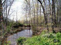
Little River
South Fork of the Little River

Little River, a tributary of the Cumberland River, originates in Christian County, KY. Its floods are a recurring theme in the history of Christian County and Hopkinsville.

As I was reading old Kentucky New Era articles about Pilot Rock recently, I came across some interesting information about Little River. In the Dec. 9, 1959, issue, a columnist reprinted an old clipping that a reader had sent to him. The author and original date of publication were unknown but it was believed to be from the New Era. The topic was the navigation of Little River in pioneer days. Part of the clipping quotes a law that was passed:

An act for keeping open the navigation of Little River in  Christian County, KY., approved Jan. 4, 1811.
     "Whereas it is represented to the present general assembly (probably of Kentucky) that great advantage would result to the inhabitants of Christian County (organized in 1792), by prohibiting all obstructions in the navigation of Little River.
     "Therefore, that from and after the passage of this act, Little River shall, as a navigable stream, remain open and unobstructed for the purpose of navigation and any person erecting or causing to be erected any fish dams, bridges or any other obstructions to passage of boats up or down said stream, shall for every offense forfeit and pay the sum of three dollars to the person aggrieved, to be recovered before a justice of the peace for every 24 hours such obstruction shall remain therein."

Source: Kentucky New Era, Dec. 9, 1959

This little item sheds some light on a question that Dennis and I had discussed a while back -- whether Little River had ever been used for shipping and transportation. We were quite sure that it had been, but it's fun to find some documentation.

The various headwaters of Little River are not very deep, but flatboats didn't need deep water. They were built at the place where the freight originated, and they were one-way vehicles. They were floated downstream, but they weren't brought back upstream.

Their [the flatboats'] cheapness and shallow draft enabled them to carry freight on most creeks worthy of the name. The produce was loaded while the creeks were more or less dry; then when a freshet occurred they were floated to the nearest river.

Source The Encyclopedia of Louisville (p. 849) by John Kleber.

After a flatboat was unloaded at the end of its trip, it was torn apart to salvage the lumber. The sale of the lumber was one more bit of income from the trip.

Dennis and I speculate that in early 19th-century Christian County, bridges across streams would have been primitive. They were probably just a tree trunk, laid across a narrow place. A fancy bridge might have been two trees, laid across the water side by side, with planks nailed across them. No wonder they were prohibited on Little River. Besides obstructing traffic, they would have snagged flood debris.

But who needed a bridge? If the river couldn't be forded, it was an opportunity for someone to make some money operating a ferry.

Wednesday, February 03, 2010

Our End-of-January Snowstorm

Just snow, no ice


We received about six inches of snow here last weekend, and we count ourselves lucky. We are happy that we missed out on the ice that storm created as it swept across the Upper South, from New Mexico to Virginia and the Carolinas.

Oklahoma
was one of the states that got a lot of ice. 10,000 electric poles may need replacing, and 70,000 homes and businesses didn't have electricity as of February 2.

South Dakota and Iowa had a bad ice storm on January 20-21 that did millions of dollars of damage. They are still cleaning up and trying to get electricity (and in some cases, water) restored.

I have genuine, "been there, done that" empathy for the folks whose lives have been disrupted by ice storms. Some readers will remember that this part of Kentucky was hit by a severe ice storm during the last week of January last year. We don't want to repeat that experience any time soon.

If you'd like to read the saga of our January 2009 ice misfortunes, the Prairie Bluestem articles are listed below. I think you'll see why we're happy with six inches of snow on the one-year anniversary!

Monday, February 01, 2010

Blog Appearance

Renovations


I'm experimenting with the layout tonight. If the blog looks strange, please check back in a few minutes, and maybe it will look better. At least, let us hope so. :)

UPDATE:

And here is the new, modified layout -- posts on the left and a single sidebar on the right. Simple enough, no? It should be a little friendlier to people who have slow connections or who are trying to read the blog from hand-held devices. It should also make more sense to search engines.

Pilot Rock at the Peak of Its Popularity

Preaching and picnics, with a great view


 A winter view of Pilot Rock, 
from its Todd County side

Pilot Rock is a locally famous landmark of Christian County. We (and many other folks who live in this general area) can see it from our house. Pilot Rock is the highest point of both Todd and Christian Counties, and it's visible for miles.

A century ago, a trip to Pilot Rock was a summer day's adventure for Hopkinsville residents. A party of young folks might leave early in the morning in a caravan of buggies or wagons, arrive at Pilot Rock in time for a picnic lunch, enjoy the view for a couple of hours, and arrive back home late in the evening, tired, but thrilled with the natural wonder they had seen.

Preaching at Pilot Rock


Joe Dorris, author of a popular column that ran for years in the Kentucky New Era, once wrote about a letter he had received from Clarence E. Mitcham of Mead, Washington. While visiting Christian County, Mr. Mitcham and his wife had climbed Pilot Rock with an elderly relative and her husband, a Mr. and Mrs. Carpenter.

The climb to the summit of Pilot Rock brought back vivid memories to Mr. Carpenter.

At the peak, Mr. Mitcham writes, Mr. Carpenter told him how Pilot Rock used to be a gathering place for many occasions.

He said he had seen so many persons at the rock that their horses and buggies would be parked around the base in an area covering several acres. The kids would play in and around the rocks. They would have a big dinner there, along with preaching.

Source: "Watching the Parade" by Joe Dorris, Kentucky New Era, October 28, 1969

Here's an example of the sort of preaching that Mr. Carpenter might have remembered. In 1895, the pastor of the Vaughan's Chapel was retiring.  (Vaughn's Chapel was roughly 4 miles southwest of Pilot Rock, cross-country. At that time, it had around 150 members .) "I want to get my congregation as near to Heaven as I can for my last sermon," Reverend Bowles said, (according to Elzie Yancey, who was then a young member of the congregation). And so, the last sermon that Reverend Bowles preached was on top of Pilot Rock. "That rock was crowded with people that Sunday," Yancey said. Fortunately, no one fell off!

The view from Pilot Rock


A fellow named Bill Hubbard lived near Pilot Rock, apparently around 1900. Mr. Hubbard owned a small telescope. He often set it up on top of Pilot Rock and charged a fee to look through it. In those days, most of the visitors hadn't seen a telescope before. They probably didn't know or care that its lens wasn't very powerful. They just marveled at the view. (Source)

"Pilot Rock, A Kentucky Wonder", published in the January 27, 1904, Kentucky New Era, mentions that the smoke of steamboats on the Ohio River could be seen from Pilot Rock with a "field glass". Perhaps the author looked through the enterprising Mr. Hubbard's telescope! The water main in Hopkinsville, 16 miles away, could be seen with the naked eye.

Even today, those who climb Pilot Rock are impressed by the view of the countryside it commands. The view was awe-inspiring, in the days before airplanes and satellites made aerial views common, automobiles and good roads made travel easy and televisions brought the wonders of the world into our living rooms.
Related Posts Plugin for WordPress, Blogger...

CONTENTMENT: Keep your heart free from hate, your mind from worry, live simply, expect little, give much, sing often, pray always, forget self, think of others and their feelings, fill your heart with love, scatter sunshine. These are the tried links in the golden chain of contentment.
(Author unknown)

IT IS STILL BEST to be honest and truthful; to make the most of what we have; to be happy with simple pleasure; and to be cheerful and have courage when things go wrong.
(Laura Ingalls Wilder, 1867-1957)

Thanks for reading.