A story of branches and forks
If you're not at all interested in the path of Little River through Christian and Trigg Counties in Kentucky, you should skip this post and make better use of your time elsewhere. If you would like to know a little more about the origins and course of Little River, then please read on.

As I wrote this post, I traced the Little River on maps I generated at the National Water Information System website for Christian County. I also consulted the Kentucky Atlas & Gazetteer, published in 1997 by DeLorme.
North Fork of Little River
The North Fork of Little River originates in the hills north and northeast of Hopkinsville. Three streams -- the Upper Branch, Middle Branch, and Lower Branch -- contribute their waters to the North Fork. Three watershed lakes -- Morris, Tandy, and Boxley -- are located on these branches. White Creek, which is dammed to form Lake Blythe, north of Hopkinsville, is another major tributary of the North Fork.
View Larger Map
The Upper Branch, Middle Branch, and Lower Branch, along with White Creek, converge one by one, forming the North Fork of Little River just before it enters northeast Hopkinsville.
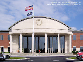
The North Fork then flows through Hopkinsville's water plant and into downtown Hopkinsville. Highway 41 crosses the North Fork near the Riverside Cemetery, and Highway 68/80 crosses it near the new Justice Center. When the stream is low, travelers of the River Walk can ford the North Fork just below the library on giant concrete lilypads.
After it passes the library, the North Fork meanders around the Indian Hills area. Highway 272 crosses it, just west of the Indian Hills Shopping Center. It wanders through the Millbrooke area in a generally southward direction toward the 68/80 Bypass. After the North Fork flows under the Bypass bridges (near the Cox Mill Road intersection) it curls around behind the YMCA and heads south again.
South Fork of Little River
The South Fork of Little River starts in the Pine Knob area, roughly 10 miles east of Hopkinsville and 5 miles northwest of Fairview, as the crow flies. The map below shows the location of Pine Knob, in relation to the four watershed lakes and Hopkinsville. The little stream that becomes the South Fork is first shown on the map about a mile southeast of Pine Knob near Pilot Rock Road,
View Larger Map
Soon the South Fork is joined by three creeks that flow out of the Butler Road area west of Honey Grove. Next, the Warrens Fork, a substantial stream that drains the hills between Honey Grove and Fairview, joins the South Fork of Little River near the intersection of Highway 68/80 and Highway 1027, east of Hopkinsville.
In times of heavy rain, the South Fork often overflows its banks. A watershed lake to help control flooding on the South Fork has been proposed several times during our time in Christian County. It has not yet been built because of the sinkholes in this part of the county. Creating a lake that holds water would require a lot more than just a dam across the South Fork.
The South Fork enters Hopkinsville at the Trail of Tears Park. Highway 41 crosses the South Fork at the Indian Chiefs Bridge. From there, the South Fork flows along Woodmill Road and on through southern Hopkinsville. It flows under Fort Campbell Boulevard near the Skyline Drive intersection, and winds southward through a frequently flooded area of homes.
South of Hopkinsville, the South Fork receives another tributary, the Rock Bridge Branch. Then the South Fork meet and combines with the North Fork near the intersection of Highway 107 (Lafayette Road) and Gary Lane. From that point, the stream is Little River.
View Larger Map
Little River
Little River flows southwest from the Gary Lane area to Herndon; its general direction is repeated by Highway 107. Before it reaches the hamlet of Herndon, it is crossed by Interstate 24. Beyond Herndon, the river makes a gradual turn to the northwest, traveling through the farmlands of southern Christian and Trigg counties on its way to the town of Cadiz.
A few miles southeast of Cadiz, Little River is joined by the Sinking Fork, a sizable tributary that drains a portion of western/northwestern Christian County. In my atlas of Kentucky, the waterways of both Little River and Sinking Fork are thickened near their confluence, to show the possibility of backed up water from the Barkley Dam on the Cumberland River.
On the west side of Cadiz, the enlarged waterway of Little River is labeled as Lake Barkley, It appears to me that, before Barkley Dam was made, Little River flowed into the Cumberland north of Canton, KY. I don't know if there was ever a little settlement at that point or not. If so, it's all under water now.
View Larger Map
The Cumberland River flows into the Ohio River at Smithland, KY, and the Ohio River flows into the Mississippi River at Cairo, Illinois. The Mississippi River flows into the Gulf of Mexico at New Orleans. Evaporated ocean waters return to Christian County as rain, and the water cycle begins again.
10 comments:
You might be interested to know that Ewing lake which feeds into South Fork Little River no longer exists. It was originally a man made lake created by putting an earth dam across a natural fall in the land and it caught a lot of water that rose in that area. Unfortunately a lot of small sink holes appeared over time in the area and the lake all but disappeared during dry spells. It was home to numerous fish - of not much size - and many turtles plus a splendid array of drgon and damsel flies during the season. The dam was eventually bulldozed and the lake bed levelled, leaving just a small pond for watering cattle.
Several streamflow gauges have also been installed to measure the level of Little River.
Very interesting, Limey, and not too surprising. I enjoyed your description of the pond life.
During the severe drought of 2007, a sinkhole opened in the North Fork at Jeffers Bend (right by the water plant in north Hopkinsville). I looked up the story in the Kentucky New Era (August 28, 2007, subscription required) to make sure I had the facts right. The article has a photo of Little River's North Fork at the water plant standing nearly empty. The article says that the stream was drained by the drought and by a sinkhole that drank up forty-two million gallons of water. Because the stream was so low, the only watershed lake that still had any water in it (Lake Blythe) could not be accessed.
Fortunately, Hopkinsville still had a couple of stone quarries that were full of water, and they were in the process of installing a waterline from Lake Barkley. The water department did issue some water conservation rules and actually turned off the water to some twenty residences and businesses that were observed in violation (watering lawns outside of prescribed times, presumably.) (This information is from a follow-up article, published on September 5, 2007 -- subscription required.)
Thanks for the link, Eric. The gauges seem to be located logically. On the South Fork, they're monitoring the water levels after streams have merged into the South Fork and in an area where flooding has previously been a problem. On the North Fork, they're monitoring at the water treatment plant. I see that they also have a gauge near Cadiz where Casey Creek and Little River converge. I'm surprised they don't have a gauge after the Sinking Fork meets Little River a little closer to Cadiz.
Thanks for the detailed description on the little river path. I have never been able to grasp the path of the north and south forks. I have actually canoed down the river when the water was high enough to navigate. We put in our canoe at Indian Hills, and took out at Gary lane. That little trek took over four hours!! There is quite a bit of meandering the river does between those two points. It is sort of disorienting when you are using the sun for direction. sometimes the sun is behind, and sometimes the sun would be in front. Kinda strange!!! Looks like we took out just before the convergence of the north and south forks. I recommend the canoe trip to anyone, you will see country that most will never see!!
Hi, John. It was educational to me to write this post. I didn't know which fork was being crossed at some of the bridges, etc. I even learned that I've been calling one of the streams out this way the wrong name for twenty years.
Your canoe trip sounds like an interesting little excursion. I have always thought it was a shame that Hopkinsville doesn't have a place to rent a canoe. Maybe the canoe-and-bicycle-rental place should be part of the RV-and-tent-camping park that we also don't have!
Thank you for excellent maps and description! It is helping me find my gr-grfather x5 John Campbell, brothers-in-law Samuel Bradley and Rowland families here in Hopkinsville KY by 1790s. All to Dawson Co Nebraska by 1890s where I was born in 1950s! Fun. God bless you! Sandra
Great article, thank you.
I'm very interested in taking a kayak trip on the LIttle River from Hopkinsville to the southwest. I would appreciate tips from anyone on where to launch and exit.
Thanks again.
Dave
Great article, thank you.
I'm very interested in taking a kayak trip on the LIttle River from Hopkinsville to the southwest. I would appreciate tips from anyone on where to launch and exit.
Thanks again.
Dave
I fished at trail of tears a few times and caught several big crappie...bluegill...goggle eye and even rainbow trout...where did the trout originate?
Post a Comment