Showing posts with label country roads. Show all posts

Monday, July 22, 2013

Messages from our Mennonite Neighbors

Bible verses along the roads


"Remember thy Creator in thy youth."


"Choose this day whom you will serve."
Over the past year or so, several signs with Bible verses have been posted along local roads by our Mennonite neighbors. I don't know whether the signs are a church project or individual efforts. Some of the signs are similar in size and style, so maybe they came from the same supplier.

The signs are written in English so they can be read by most people who pass by.  But actually, the Mennonites usually read the Bible in German.  Their Heilege Schrift (Holy Scriptures) is/are written in "Bible German," a form of High German that's different from the Pennsylvania Dutch they speak at home. Mennonite children learn Bible German along with English, as part of their education.

"Honor thy father and mother."
A young Mennonite neighbor lady once told me that "sometimes we look in the King James Bible" if a passage in the Mennonite Bible is hard to understand. I am not sure if she was speaking for all or just speaking for her own household.  The archaic English of the King James Version is surely as difficult as Bible German, but the Mennonites probably assign extra virtue to the KJV simply because it is old.

But let me get back to the signs around the neighborhood. I respect our neighbors for trying to "be a good light". (A Mennonite neighbor lady, telling me how Mennonites should live, used that phrase.) But I do wish they'd put the signs on posts instead of nailing them to trees. These trees growing wild in the fence rows aren't particularly valuable, and they'll probably survive the nails, but it still bothers me. I hate to see things nailed to living trees, no matter who does the nailing.

"Repent & be converted that your sins may be blotted out."
"God will judge the world in righteousness."

Saturday, July 20, 2013

Road Trip through the Ozarks

Christian County, Kentucky, to Hickory County, Missouri


Recently, I took a few days off from the usual humdrum and made a fast trip west to visit my family. I drove to Wheatland, Missouri, and picked up my sister; then she rode along with me to Kingman County, Kansas, where we spent several days visiting with my brother and sister-in-law. Then I took my sister home again, and came back home myself. The entire trip was about 1500 miles.

Here are some of the sights from the first day, as I traveled from Hopkinsville, Kentucky, to southwest Missouri.

 This gas station in Wickliffe, Kentucky, is a familiar landmark just before the long approach through the swamps to the Ohio River bridge.

There was no traffic on the bridge over the Mississippi River, so I drove slowly, put my camera out the window, and blindly took some pictures. Most of them were out of focus and wildly tilted (not surprising,) but this one isn't too bad. The trees are growing on the extreme southern tip of Illinois. The Ohio River is on the far side of the trees and the Mississippi River is in the foreground. The two rivers come together in front of the trees and continue as the Mississippi to the ocean.


Much of the land in the Missouri Bootheel was cypress swampland until the 1890s. It was considered a great engineering accomplishment when nearly all the trees were cut and the swamps were drained and converted to farmland. Today, it's a very productive agricultural area, but a rich and complex ecosystem has been lost forever.


Most of the hay harvest this year in southern Missouri and southern Kansas was put into big round bales like these. We did see a few big square bales in Kansas. We speculated that they could be packed closer on a truck than round bales and that they would be more stable during transport.


In a gas station, I saw this stuffed bobcat and bird (I think it's a quail.) I don't think they'd win any taxidermy prizes, but they certainly were attention-grabbing, especially for little children.


The other end of this shop in Van Buren, Missouri, was more modern and less cluttered, but I really liked the look of this end. Van Buren always has something interesting to see. I took a few minutes off to drive around town and look at the Current River.


My next stop was at Winona, where I pulled into a gas station to study the map and plot a route across the Ozarks. I had finished my map reading and I was waiting at the stop sign to get back on Highway 60, when a woman in a Ford Explorer rear-ended my car. She was apologetic, but she didn't explain to me why she did it. My car didn't appear to be damaged, but I got her insurance information anyway. "Just in case," I told her.


I pointed my camera at the road as I went down some of the big hills. Here are two pictures that turned out all right. I'm thankful for Highway 60 which is all four-lane these days, but I always enjoy the point in the journey when I turn northward on a two-lane and head across the Ozarks toward Wheatland. I've seen some great scenery from the two-lanes in the Ozarks.

I usually go through Lebanon, but I decided to take some blacktop county roads (about 50 miles of them) and go through Buffalo instead. (This information is for those who really know their southern Missouri geography.) That's how I happened to pass through Conway, and by the way, it was the first town I'd seen in quite a while.


I finally arrived at my sister's house a little before sunset. When I opened the trunk of my car, I couldn't close it again. Once opened, the two parts of the trunk latch were misaligned and impossible to connect. So I called the woman's insurance company and made a claim that night.  (Lesson: Always get the insurance info, even if the car does not appear dented at first glance!)

For the rest of the trip, I had to fasten the trunk with a bungee-cord. We put most of our gear in the back seat because it was more convenient. When I got home again, I took the car to the body shop for an estimate, and the guys there bent it back enough to close it properly. Now, I'm just waiting for the appointment in about a week to get it fixed for good.

Thursday, December 02, 2010

Tuesday, July 27, 2010

Rattlesnake Road

A back-road in rural Todd County, Kentucky


Rattlesnake Road, at
its intersection with
Allegre Road (Hwy. 171)
Last winter, I posted a photo I had taken of a creek ford on a rural road in northwestern Todd County, Kentucky. A visitor to the blog asked if the ford was on Rattlesnake Road. It wasn't -- it was on Flat Rock Road -- but the question planted a seed of curiosity in the wanderlust corner of my heart.
I decided that I would like to travel Rattlesnake Road when the weather dried up, and I said as much to the visitor. He (or she) replied:

Oh...then just trust me, Rattlesnake Road looks just about like your Flat Rock Road. I mean, you don't have to GO THERE...Rattlesnakes...and all...

My only trip there was in the summer years ago, the creek was incredibly high and there was no safe way to have crossed it. There was a roadway to the water's edge (and through it I presume) and a roadway came out the other side.

You could not have paid me any amount of money to get out of my car. Just the thought of it even today gives me the heebie jeebies!

Those words convinced me that I had to visit Rattlesnake Road and see its creek ford with my own eyes.

Wednesday, February 24, 2010

Buggy

Mennonite neighbors, headed home


Life slows down on our country lane -- sometimes, anyhow.

Tuesday, February 09, 2010

The View from My Porch

Another February snow


We had a good five inches of snow at our house during the night. Dennis walked down to the highway this morning about 8 a.m. to check the driving conditions. He watched someone try to drive up the hill east of our mailbox, and he was sliding all over the road. That convinced Dennis that I should call work and tell them I couldn't make it. So I've had an unexpected vacation day.

During the day, the snow melted enough that I could see the sidewalk, but this evening, enough snow fell to cover it again. It's 18° now, and any slush or water on the roads has frozen hard. Also, the weather report says that drifting is possible due to the strong winds, even though the snow is heavy.

There was no school in Christian, Todd, Trigg, or any other nearby county today. Most of them have already cancelled for tomorrow, too. The  National Weather Service reports 7.5 inches of snow at Princeton, 6.5 inches at Dawson Springs, 6 inches at Madisonville, and 5 inches at Hopkinsville.

Some years, the daffodils start blooming in mid-February! However, at about this same time of February, 2008, we had a substantial snow.

Friday, March 27, 2009

Mennonite Farm

Somewhere in time


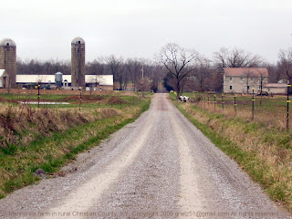
Christian County, Kentucky, has many Mennonite and Amish farmers. In our part of the county, many of our neighbors are Mennonites. This farm (photo above) belongs to one of our Mennonite neighbors.

The yellow strip just past the tree in the center of the photo is a long row of daffodils, blooming beside the vegetable garden. In the summer, red cannas bloom at the garden's edge.

The Mennonite farmers around here are fond of concrete stave silos like the ones in the photo. These silos aren't used much by other farmers, nowadays. The Mennonites will often buy an old silo that's been sitting empty for years, tear it down, rebuild it, and put it back into use. It's a good deal for everyone involved.

The home in the photo is typical of dozens of recently-built Mennonite homes in this area. Most are large, plain, 2-story structures with attic space for storage. The wide front porch (not visible in this photo) is a good place for drying laundry on a rainy day. The main door usually opens to a big kitchen, in true farmhouse style.

I think this photo could pass for a scene from half a century ago, except for a few details -- the machinery in front of the barn and the style of the electric fence posts might be too recent. But just put those minor items out of your mind, and click here to see the same image in black and white as it might have been captured in an earlier time.

Monday, December 15, 2008

First Winter Storm of 2008-2009

Icy roads expected


As the solstice approaches, winter is upon us. Saturday's weather forecast suggested we might have freezing rain on Monday. On Sunday, a winter weather advisory was issued for Monday and Monday night.

Now it's Monday, and the weather has arrived. The temperature is 31° and light rain is falling. The weather advisory has become a Winter Storm Warning. An inch or more of sleet, ice, and snow is expected over the next 18 hours.

I was supposed to work from 10:30 am to 6:15 pm today. As I was ready to walk out the door, a  manager from my store called and begged to change my schedule to 2:30 pm to 10:15 pm.  A co-worker has cancelled. She drives about 20 miles to work and she is afraid the roads will be bad tonight.

I reluctantly agreed, though I live nearly as far from work as the other woman does, and my roads are not nearly as well-traveled. Furthermore, I have to be back at work early in the morning. There is no justice in this, and I probably won't even get a thank-you, but I guess I'll survive.

I'm feeling cranky -- have you noticed? Little things on the radio are irritating me. For example:

  • The Pajama-grams commercial -- are men so easily manipulated by fantasies? I suppose they are.
  • Are there really people who would pay to have stars named after them?
  • Anyone who says "incentivize" a dozen times in 30 seconds should have shoes thrown at them.

On the bright side, I have plenty of time before work today to take Grandma's box of Christmas candy to the UPS store. I'll even have time to go to the antique store to look for one of Isaac's Christmas presents. (No, I can't tell you what it is. Isaac does read the blog.)

I hope my northern readers have been able to stay inside and avoid the sub-zero wind chills today, and I hope my northeastern readers have electrical power, or at least, reasonable hope of power restoration soon.

And I hope all of you are giving the weather the respect and caution it demands. If you don't have a winter survival kit in your car, please assemble one that's appropriate for the potential dangers you face on your roads.

Related post:
Prairie Bluestem: Ready for Winter?

Saturday, August 16, 2008

Duff Valley

Southern Rock County, Nebraska


Here are a few photos of the Duff Valley in Rock County, Nebraska. This is the neighborhood where I grew up. I took these pictures during the several quick visits I've made there in the last decade or so.


About 26 miles south of Bassett, Nebraska, a gravel road runs west from the highway, over the Adams Hill, through the Duff area and on through the Sandhills to Long Pine. When I visited Duff in 2000, this sign (above photo) marked the turn-off from Highway 183. Some of the names on the sign are familiar to me as new generations of old neighbor families, and some names are new to me.


This photo of the Duff School, my grade school alma mater, was taken during our visit in 2000. The people in the photo are Aaron Rowse, my daughter Keely, my son Isaac, and me. I was surprised that the school building was so small! I remembered it as a larger structure. The Duff School was located 3 miles west and 1 mile south of Highway 183.


We drove through the Duff area again in early June of 2002. I was surprised to see all the Canada geese on this meadow, along the Duff road about 3-1/2 miles west of Highway 183.


The Duff Cemetery had just been cleaned for Memorial Day, and it really looked nice. I hadn't remembered it as such a pretty little country cemetery. However, it was a bit of a shock to see tombstones for people whom I used to know. The Duff Cemetery is located about 3-1/2 miles west of Highway 183, or about 1/2 mile east of Duff (point A) as shown on this Google map.


I was surprised to see that many of the cottonwood trees in Duff Valley (and throughout Rock County) are dying. They live about 100 years, so it's been about that long since many of them were planted by early settlers.

This is the gate of the ranch where I grew up. The ranch buildings (photo below) are a little over a mile from this gate, by the road. The buildings have deteriorated, especially the big barn. The ranch has had several owners since we lived there, and times have been hard. I don't know if anyone is living there now or not.


The Duff Church, which I wrote about recently, was 4 miles west from Highway 183. To reach our place (above), we turned south at the Duff Church, and followed the county road and then the ranch road for about another 2 miles.


These photos were taken a few miles west/northwest of Duff. These wetlands are probably some of the headwaters of the Skull Creek that runs through the Duff Valley. Actually, these scenes are closer to the former post office of Spragg (opened 1888, closed 1912) than to the former post office of Duff (opened 1886, closed 1901, and open again 1903-1953).

Related:
Some Memories of Duff, Nebraska
Posts on this blog that mention Duff, Nebraska

Thursday, March 06, 2008

Wild March Weather

A week of dramatic precipitation


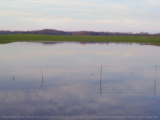
Flooded wheatfieldA flooded wheatfield, east of Hopkinsville, KY

Just a couple of days ago, Christian County got a big rain -- four to five inches or more, depending on the location. The rain fell fast and hard, and some streets and roads were impassable because of high water.

The newspaper had a couple of stories about foolish people who attempted to drive through high water. One woman drove down a water-covered road and attempted to cross the river on a flooded bridge. Her car stalled out, and she had to get on the roof and wait for rescue.

Another guy drove around "Road closed" signs and barriers. As he tried to navigate the flooded street, his car was carried away by the current. Fortunately for him, the car stuck in some trees in several feet of water, and he didn't go into the river. He also sat on his car roof until he was rescued. (Source: Kentucky New Era, subscription required.)

Tonight, we're wondering how much snow we will get. A winter storm warning is in effect until noon on Saturday. The forecast calls for a little rain, some snow, some rain mixed with snow, and then more snow -- all in all, four to seven inches of snow, accompanied by wind. If it snows and blows as predicted, our lane and blacktop roads will have snowdrifts across them.

The Christian County School District has already announced that school is cancelled for tomorrow. I have to work tomorrow, but if it is snowing heavily, I intend to leave before sundown. I don't want to bust snowdrifts in the dark.

Isaac is supposed to work until 9:00 p.m. tomorrow night. I'm not sure how that's going to work out, but he won't be busting snowdrifts in the dark either. If necessary, I'll call the store myself and tell them he needs to get home.

I'm imagining the worst -- blizzard conditions, impassable roads, and unreasonable supervisors. It probably won't be nearly that bad. On the other hand, I hope all of us will be prudent citizens who don't need rescue.

Thursday, February 21, 2008

Deer at Sunset


Deer at sunsetDeer in a neighbor's field


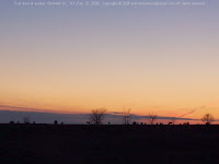
If you click on this photo and enlarge it, you'll see four deer along the horizon. I stopped to take this photo, thinking I'd post it with a comment about the bank of clouds that might be the ice storm we're expecting tomorrow. When I saw the deer, I wasn't very surprised. I often see deer crossing the highway in this vicinity, and it doesn't have to be sunset. They cross at all hours of the day and night. It's best to drive slowly and keep your eyes open when you come through here.

Tuesday, February 05, 2008

Tornado Damage at Crofton KY, Tonight

Another night of severe weather in Christian County, KY


This report is for the people who are visiting the blog seeking information about the tornado in the Crofton, KY area, tonight.

Related post: Tornado Damage Reports, Crofton, KY, Area, 2-5-08

Around 7 p.m. tonight, a tornado cut through northern Christian County from Cerulean, across Dawson Springs Road and Old Palestine Road, and through Empire. The Pembroke area also suffered some wind damage.

No serious injuries or loss of life have been reported so far, so we've been more fortunate than many communities this stormy night.

The Kentucky New Era sent out a reporter after the storm and posted a story about the tornado that hit northern Christian County. According to the KNE story, damage includes power lines and transformers lying on the ground, roofs ripped off houses, barns and mobile homes destroyed, and trees blown over.

Our local news radio station, WHOP AM, was broadcasting full-time storm coverage as the front passed through the area. The broadcast included the audio portion of one of the Nashville television stations as their weather people watched the regional radar, took in storm reports, etc.

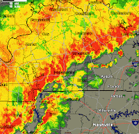
We are now under another severe thunderstorm watch. On our current radar map. Hopkinsville and Christian County lie directly in the path of a squall line. When this passes, the temperature is supposed to drop rapidly, and then, perhaps we'll have a quiet rest-of-the-night.

Below, I've posted the National Weather Service damage reports that appeared on Weather Underground.

- - - - - - - - - - - - - - -

02/05/2008 0954 PM
Pembroke, Christian County.
Thunderstorm wind damage, reported by trained spotter.
Late report. Widespread power outages near Pembroke area. Deck off of home near Interstate 24 exit 86 along Good Hope Cemetery Road.


02/05/2008 0735 PM
3 miles SW of Crofton, Christian County.
Tornado, reported by trained spotter.
On Old Palestine Road... numerous houses damaged or destroyed and people are trapped in homes. Emergency personnel en route.


2/05/2008 0730 PM
3 miles E of Bainbridge, Christian County.
Thunderstorm wind damage, reported by law enforcement.
Several structures and numerous trees and power lines down on Old Palestine Road


02/05/2008 0730 PM
3 miles SW of Crofton, Christian County.
Thunderstorm wind damage, reported by law enforcement.


Sunday, December 30, 2007

Wild Sandhill Prairie

Out in the hills, the Middle of Nowhere still exists


Sandhill prairie

When I was growing up, we lived about eight miles from a wide-spot on the highway known as Rose, Nebraska (population 2.) Our house was about six miles off the highway and about 32 miles from the nearest real town.

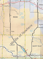
Rock County and surrounding Nebraska counties
I grew up in the Duff Valley, just west of the Middle of Nowhere.
People sometimes remark that I grew up in the middle of nowhere, but actually, there were quite a few neighbors in and around the Duff Valley where we lived. Our nearest neighbor lived about a mile and a half away. Our mailbox was only a mile from our house, where our land met the nearest county road.

The most sparsely-populated area of Rock County was east of where I lived. At that time (1950s and 1960s,) no improved road went through the hills from Rose on U.S. Highway 183 to Nebraska Highway 11, the road to Burwell. You could drive through, but when you came to the end of the maintained road, you had to open gates and follow some very rough and sandy two-track pasture roads. A four-wheel drive pickup truck was recommended.

Times have changed. Nowadays, there's a road all the way through from Highway 11 north of Burwell, Nebraska, to Highway 183 just north of Rose, Nebraska. Along the way, you pass the Sitz Ranch, the Gurney Ranch, and the Rose Church. It's a beautiful drive through Sandhills prairie that is still much as God made it. The road truly does go through the Middle of Nowhere.

I don't recommend the drive if you are a timid driver who is likely to get stuck in a sandy spot (can't slow down, must keep going or you're sunk!) You also need a clear understanding of where you're going and a good inner sense of direction (or a GPS unit.)

It was a great joy to drive my kids through this wild area of southeastern Rock County several times when we went on vacations to Nebraska. I think it gave them a better understanding of what the Sandhills are like and where their mother is from.

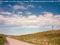
The photos in this post were taken along the road somewhere in the hills east of the Rose Church. In the image at the top of this post, the windmill is on top of the hill so it can catch enough wind to provide water for the cattle. The water tank is in the "pocket" down below, between the hills.

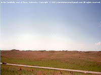
The image below is taken from the hill where the windmill stands. You can see the wind-sculpted peaks and pockets of the dune formations. Indeed, the Nebraska Sandhills are grassed-over sand dunes, the largest area of sand dunes in the Western Hemisphere.

One thing I should make clear -- this is not the only Middle of Nowhere. Many other remote, unspoiled, rural areas still exist in the United States -- and I'm glad that they do.

East of Rose, NE

Saturday, July 07, 2007

A Rainy Week in Christian County, KY

Above average rainfall last week eases drought conditions


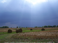
Approaching rain cloudJust before the rain


We've had a week of above-average rainfall, and it's looking a bit greener here. The rain cloud in the above photo bypassed our part of the county, but we had various other showers. We didn't have any big rains, but it was enough that we are back in moderate drought rather than severe drought. The ground is still hard as a rock, but the fields and pastures look greener.

Our Mennonite neighbor's cornfield west of our house and his nearby beanfield looks the best of any crops around. Willis, who studies the weather avidly, says that we've had several showers right here that other parts of the county didn't get. That very fact shows what an odd year this is. Usually, our little area stays dry while it rains all around us.

An hour ago, I watched a beautiful pink sunset over the cornfield. The aroma of corn silk and tassels was thick in the air. It's one of those hot, humid Kentucky evenings when you should drive down a country road with your windows open, and smell the vegetation, and listen to the tree frogs singing.

Related post: Too Dry in Kentucky

Technorati Technorati tags: , , ,

Wednesday, April 04, 2007

Late Freeze

Life in Christian County, Kentucky... More About Trees and Plants...


Early leaves may be frostedAn image from our walk tonight


Isaac and I walked after supper tonight, and the sun was setting by the time we got home. Along the way, we could hear the wind in the treetops and feel it cold against our faces. It's going to freeze tonight. The overnight temperatures are supposed to be in the 20's for the next four nights.

The freezing temperatures will be hard on the trees. Some are blooming (the oaks and others) and if those blossoms are killed by a hard frost, that means they won't have their fruit this year -- acorns or elm seeds or maple seeds or whatever. That would make it hard for the birds and animals that depend on those foods.

Some of the trees have already put on their leaves. The tender little leaves may be frozen, and if so, they'll probably die and drop off, and the trees will have to start again.

We had a similar spring six or seven years ago with a late freeze that killed back the leaves. I remember that all the new little leaves on the privet bushes in the yard dried up and fell off.

It's a shame, but it's a fairly minor natural disaster compared to tornadoes and 30-foot tsunamis.

UPDATE:

On my tree blog, I've posted some links to recent articles about caring for freeze-damaged trees and shrubs.

Technorati Technorati tags: , , ,

Thursday, March 29, 2007

The Nightly Walk

All In The Family... Life in Christian County, Kentucky... The Rural Life...


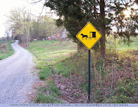
Rural road with horse and buggy hazard signThe road where we've been walking

Isaac and I have been taking an evening walk whenever we can, and we find ourselves returning to the same little road nearly every time.

It's such a narrow, quiet road that it's like following a path through the woods -- and I suppose that it was a path once. We haven't yet seen a horse and buggy on the road despite the warning sign at our starting point, and we usually meet only one or two automobiles.

A Mennonite family lives along our route, but their place is hidden by the trees. Their buildings are newly-built because no one has ever lived there before. I think they moved here about a year ago.

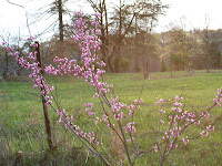
Young redbud blooming A young redbud tree beside this country road
The cemetery that Isaac restored for his Eagle Scout project (see the links below) is out in the pasture along this road. We can see it from the road, but if we didn't know it was there, we'd never notice it.

We turn around at the point that the road changes from gravel to blacktop, but another Mennonite family lives farther down the road on the blacktop part. The wife runs a greenhouse, and she is one of the most gifted gardeners and landscapers I've ever known.

She doesn't advertise, but she does a lot of business, especially in the spring. Her prices are reasonable, she has a good selection of healthy plants and she always throws in something for free. Cars are always parked in front of the greenhouse with their trunks open, and you will probably see some horses and buggies tied to the hitching posts, too.

After walking the gravel part of this rustic country road a few times, we decided we'd pick up the many aluminum cans in its ditches and recycle them. We got most of them in a couple nights, and we are still finding one every now and then. They are mostly beer cans. Apparently the teenagers party on this road, or perhaps it is the hunters.

Tonight we started picking up some of the dozens of glass and plastic bottles in the ditches. We both filled our Wal-Mart sack in just a short distance. All of the glass is beer bottles, of course, and all of the plastic is soda bottles. We decided we would leave the paper litter since it will bio-degrade eventually.

This project will take a few weeks, but we hope to get that scenic little country road cleaned up.

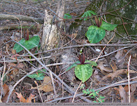
I don't know the name of the plant below, so please tell me if you know it! It looks like it may turn into a vine? I saw it along the roadside at the base of a tree.

What is the name of this plant? What is the name of this plant?


Related posts:
Mid-March in the Kentucky Countryside
Eagle Project is Taking Shape
Eagle Project Begun
Peaceful Valley

Sunday, March 25, 2007

Shiloh Baptist Church, Christian County, KY

Life in Christian County, Kentucky...


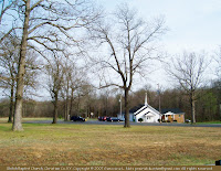
Shiloh Baptist Church in rural Christian Co., KentuckyShiloh Baptist Church


This is the Shiloh Baptist Church in northeastern Christian County, KY. It's about 10 miles from Hopkinsville as the crow flies but farther by the roads. The Shiloh Church Road is named for this church. The church sits beside the Shiloh Church Road, a few miles southeast of a crossroads and tiny community that is known as Carl. The terrain around it is high, rough, and rocky, but the church sits in a little valley surrounded by tall oak trees.

Bar

Technorati tags:


Sunday, March 18, 2007

Mid-March in the Kentucky Countryside

Life in Christian County, Kentucky... The Rural Life...


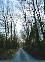
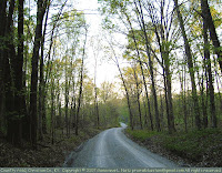
Rural road, Christian County, KYIsaac and I had a nice walk late this afternoon, down a narrow and somewhat winding road near our home. It's about .8 mile from the beginning of the road to the point that it changes from gravel to blacktop. The round trip is 1.6 miles with a couple big hills to increase the heart rate.

The road is so narrow that two vehicles cannot meet on it. When that rare event does occur, one has to either back up or wait in a pasture gateway along the road until the other vehicle passes.

We didn't meet any vehicles at all while we were walking. It was very quiet and pleasant, walking along through the trees and beside the pastures and fields.

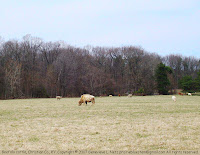
Cattle herd in Christian County, KY Our neighbor has his Beefalo cattle in some of the pastures along the way. The buffalo ancestry of his bull is quite obvious.

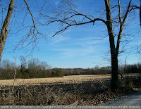
The fields haven't been touched yet, but I'm sure the farmers are preparing their machinery and ordering the seed.

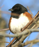
Rural scene, Christian County, KYComing back up the last hill, we heard a bird calling close beside the road. Isaac spotted him in a thicket when he moved. It was an eastern towhee (also called a rufous-sided towhee.) I have seen them in our yard infrequently, but often enough that I recognize them.

After listening to some recordings of the towhee's calls on the internet this evening, I realize that he was making the "towhee" sound that the bird is named for. You can read more about the eastern towhee and hear its call on the Cornell Lab of Ornithology website (Real Player needed) or on the Wild Bird Watching website (mp3 player needed).

The weather here has been so nice lately for walking -- cool, but not cold. This is the second time that Isaac and I have walked down this road this week. We can walk up and down the hill from our house to the highway three times and have about the same distance, but a change of scenery always makes walking more interesting.

Eastern or rufous-sided towhee
Eastern towhee, National Park Service photo


Bar
Technorati tags:


Related Posts Plugin for WordPress, Blogger...

CONTENTMENT: Keep your heart free from hate, your mind from worry, live simply, expect little, give much, sing often, pray always, forget self, think of others and their feelings, fill your heart with love, scatter sunshine. These are the tried links in the golden chain of contentment.
(Author unknown)

IT IS STILL BEST to be honest and truthful; to make the most of what we have; to be happy with simple pleasure; and to be cheerful and have courage when things go wrong.
(Laura Ingalls Wilder, 1867-1957)

Thanks for reading.